

So I finally had my chance to ride this Alp crossing. It is situated on the border of Switzerland and Austria, close to Samnaun. My starting point was the camping of Strada (CH). This camping has been around for many years, and now it has new owners, who made some improvements. the camping is still basic but with a modern wash/shower building. It is a very good location to make several day tours, all of them epic as far as I am concerned:
First, the route trough the Uina Slucht, which starts at Sur En. This route leads trough a very narrow canyon, the route has been carved out from the steep rocky walls. you need to push the bike on this stretch, but the surroundings are magnificent.
Secondly, from Scuol, the easier but longer and no less interresting route through the valley to the village of S-Charl, and then on to the Pass Da Costainas. you can ride this one all the way to the top.
Both of the routes you can start from the campgound: just follow the quiet bikepath along the Inn river to mentioned villages.
and thirdly; the route over the Fimberpass. As far as I am concerned, it is the most difficult one, and therefore not without reason that it took so long for me to (individually) ride this one. I took the post bus from Martina, to take me to Samnaun Dorf (1842m). From there, I went to the Zeblas Joch (2538m). At this point you have the choice to ride along the Paliner Kopf And Greitspitz to Flimspitz (2730m), or decend straight down to the Gampenalpe. I took the first option, a wide gravel stretch with three very steep sections to get to the Flimspitze. this route is constructed to connect all the mountain stations that are constructed for skiing. From the Flimspitze (you are in Austria now) you decend along some nice wide gravel tracks that change into single track. the single track part has some nice “Northshore” style decks (vlonders) and some steep sections that need to be done walking (up as well as down). When you are down in the valley at 1816m, the climb to the Heidelberger hutte (2264m) starts.


Next time, I would choose to descend straight down, because the route is tough enough already without the section along the grat.

When riding up again to the Heidelberger hutte, you cross the border to Switzerland. you can notice how different both countries develop the Alps: Austria has an extensive skiing “arena” network with all the bells and whistles while in Switzerland it is just nature and small scale agriculture. Personally, I like the latter one, but I can understand that in wintertime, when all is covered in under a pristine layer of snow, things don’t look so bad.


The heidelberger hutte is a nice place to make a stop before going to the Fimberpass (2609m). The section is steep and I estimate about 50% of the distance the bike needs to be pushed or carried. from the top there is a magnificent view over an almost surreal landscape. the descent is very rocky with loose rocks and smaller stones, partly needs to be walked but the majority can be ridden. Keep in mind that, when crossing the treeline, it still takes a long time and distance to get back into civilisation.


It is a very nice but also very tough ride in my opinion. As others will say too: you need to have dry weather, otherwise it might be too dangerous to do this trail. I did 63km, 2324hm and 6 hours to complete this one. Around Strada it is indeed the hardest one to ride, and often part of a TransAlp route because the next day you can do the Uina slucht on your way to Italy.

Hoi Ilona,
tot nu toe gaat het goed alleen zijn we nu in het Zuiden van Kroatie waar het stikheet is en weinig schaduw. Dat is wat minder, vooral om er voor te zorgen dat Binkie niet oververhit raakt. We zijn op weg naar Montenegro, in de bergen is het wat koeler. Maar vanwege corona moeten we via de kust van Kroatie, omdat alleen daar de smalle landtong van Bosnie je zomaar de grens over kunt zonder coronagedoe. Dus we kijken al uit naar de koelte van de bergen.
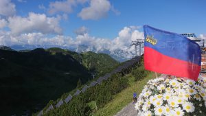
We hebben besloten om elke maand een verslag van die maand te plaatsen. Per week is wat teveel soms staan we een paar dagen op dezelfde plek. Die van augustus komt een deze dagen. Ook zit er een verhaaltje over Binkie in mijn hoofd maar nog niet op papier. De route kun je in grote lijnen volgen. Maar als je meer details wilt weten over een bepaald gebied om er zelf eens naar toe te gaan dan mail maar. Overigens kan ik Liechtenstein dan aanraden. Verrassend veel te bieden voor zo’n klein landje. Relaxte sfeer.
We hebben geregeld weinig tot geen internet omdat wij veel van de gebaande paden afgaan, dus het duurt soms wat langer voor we kunnen reageren of de website kunnen updaten.
Kilian vond jouw “kaart” ook erg mooi en ik heb deze veilig opgeborgen in de doos met bewaarspulletjes die bij mijn schoonmoeder staat.
Groetjes,
Marcia
wow, mooie en uitdagende tocht! hoop dat er nog vele mogen volgen in de hooggebergten gedurende je reis.